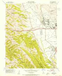
1953 Map of Dublin
USGS Topo · Published 1955About this map
Parks Air Force Base dominates the northeastern landscape of this mid-century survey, its expansive grid of barracks and roads sitting between the Amador Valley and the Santa Rita Valley. The adjacent Komandorski Village and the town of Dublin represent the early residential and military-support footprint of the era. To the south, the city of Pleasanton is anchored by the Alameda Co Fairgrounds and the Southern Pacific rail line, showing a community still distinct from its neighbors before suburban sprawl connected these valleys.
Find a feature on this map
60 named features on this map. Tap any name to fly to it.
Don’t see what you’re looking for? This feature index may not catch every label — zoom into the map to look around manually.
Map Details
Editions of this 1953 Dublin Map
2 editions found
Other maps of this area

1896 · Mt. Diablo
USGS Topo · 1:62,500

1897 · Concord
USGS Topo · 1:62,500

1898 · Mt. Diablo
USGS Topo · 1:62,500

1899 · Haywards
USGS Topo · 1:62,500

1906 · Pleasanton
USGS Topo · 1:62,500

1915 · Haywards
USGS Topo · 1:62,500

1915 · Concord
USGS Topo · 1:62,500

1941 · Pleasanton
USGS Topo · 1:62,500

1942 · Concord
USGS Topo · 1:62,500

1942 · Hayward
USGS Topo · 1:62,500