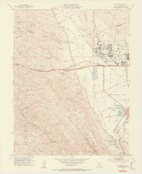
1953 Map of Dublin
USGS Topo · Published 1955About this map
Amador Valley serves as the central hub of this mid-century landscape, where agricultural fields and emerging infrastructure meet the foothills of the East Bay. The map illustrates a transitional period for the community of Dublin, which features both the active Murray School and the nearby Murray Sch (Aband), reflecting shifts in local education and settlement. Further east, the Santa Rita Rehabilitation Center and the Alameda Co Fairgrounds occupy significant tracts near Pleasanton.
Find a feature on this map
60 named features on this map. Tap any name to fly to it.
Don’t see what you’re looking for? This feature index may not catch every label — zoom into the map to look around manually.
Map Details
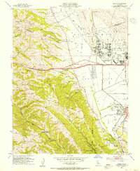
Editions of this 1953 Dublin Map
2 editions found
Other maps of this area

1896 · Mt. Diablo
USGS Topo · 1:62,500

1897 · Concord
USGS Topo · 1:62,500

1898 · Mt. Diablo
USGS Topo · 1:62,500

1899 · Haywards
USGS Topo · 1:62,500

1906 · Pleasanton
USGS Topo · 1:62,500

1915 · Haywards
USGS Topo · 1:62,500

1915 · Concord
USGS Topo · 1:62,500

1941 · Pleasanton
USGS Topo · 1:62,500

1942 · Concord
USGS Topo · 1:62,500

1942 · Hayward
USGS Topo · 1:62,500