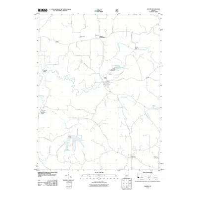
2010 Map of Dubois
USGS Topo · Published 2010About this map
The Patoka River winds through the heart of this Southern Indiana landscape, defining a rural corridor between the settlements of Dubois and Celestine. This area of Dubois County is marked by a network of family-named landmarks and local infrastructure, such as the John Seitz Bridge and the Crystal Station Bridge over the river. The topography shifts into the Harbison Hills in the northeast, while several community-oriented water features like Dubois Community Club Lake and Beaver Creek Lake illustrate the local management of the watershed. Genealogists and local historians will find significant value in the distribution of burial grounds, including the Harbison Cemetery, Ewing Cemetery, and Hardin Cemetery, which are scattered throughout the agricultural plots and wooded sections. Smaller rural hubs like Crystal and Kellerville anchor the outlying roads, preserving the spatial layout of these traditional communities.
Find a feature on this map
56 named features on this map. Tap any name to fly to it.
Don’t see what you’re looking for? This feature index may not catch every label — zoom into the map to look around manually.
Map Details
Editions of this 2010 Dubois Map
This is the sole edition of this map. No revisions or reprints were ever made.
Other maps of this area

1946 · Jasper
USGS Topo · 1:24,000

1951 · Hillham
USGS Topo · 1:24,000

1954 · Dubois
USGS Topo · 1:24,000

1954 · Huntingburg
USGS Topo · 1:24,000

1955 · Saint Anthony
USGS Topo · 1:24,000

1956 · Alfordsville
USGS Topo · 1:24,000

1956 · Rusk
USGS Topo · 1:24,000

1956 · Vincennes
USGS Topo · 1:250,000

1957 · Vincennes
USGS Topo · 1:250,000

1957 · Cuzco
USGS Topo · 1:24,000