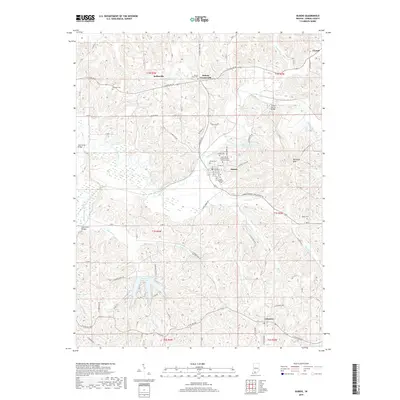
2019 Map of Dubois
USGS Topo · Published 2019About this map
The Patoka River winds through the heart of this Dubois County landscape, anchoring a region defined by scattered rural settlements and family-named cemeteries. In Dubois, the community cluster includes the Saint Peters United Church of Christ and the nearby Saint Raphaels Cem. These small centers, including Kellerville and Dubois Crossroads, reflect a traditional Indiana settlement pattern where local life is centered around church parishes and crossroads commerce.
Find a feature on this map
74 named features on this map. Tap any name to fly to it.
Don’t see what you’re looking for? This feature index may not catch every label — zoom into the map to look around manually.
Map Details
Editions of this 2019 Dubois Map
This is the sole edition of this map. No revisions or reprints were ever made.
Other maps of this area

1946 · Jasper
USGS Topo · 1:24,000

1951 · Hillham
USGS Topo · 1:24,000

1954 · Dubois
USGS Topo · 1:24,000

1954 · Huntingburg
USGS Topo · 1:24,000

1955 · Saint Anthony
USGS Topo · 1:24,000

1956 · Alfordsville
USGS Topo · 1:24,000

1956 · Rusk
USGS Topo · 1:24,000

1956 · Vincennes
USGS Topo · 1:250,000

1957 · Vincennes
USGS Topo · 1:250,000

1957 · Cuzco
USGS Topo · 1:24,000