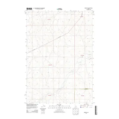
2013 Map of Dubois NE
USGS Topo · Published 2013About this map
Camas Cr meanders across the southern landscape of this 2013 survey, following a winding path through the high plains of eastern Idaho. The area is defined by its agricultural and ranching heritage, centered around the Jacoby Ranch in the eastern portion of the quadrangle. A distinct boundary between Clark Co and Fremont Co bisects the southeastern corner, illustrating the administrative divisions of this high-altitude terrain. The road network is sparse, primarily consisting of Jacoby Rd and the long diagonal of A-2 Clark Co Rd, which cuts across the township lines. Along the eastern edge, Gravy Ridge Rd follows the local topography, providing access to the more elevated stretches of the region's range land.
Find a feature on this map
12 named features on this map. Tap any name to fly to it.
Don’t see what you’re looking for? This feature index may not catch every label — zoom into the map to look around manually.
Map Details
Editions of this 2013 Dubois NE Map
This is the sole edition of this map. No revisions or reprints were ever made.
Other maps of this area

1955 · Dubois
USGS Topo · 1:250,000

1955 · Ashton
USGS Topo · 1:250,000

1958 · Dubois
USGS Topo · 1:250,000

1958 · Ashton
USGS Topo · 1:250,000

1960 · Ashton
USGS Topo · 1:250,000

1964 · Dubois NW
USGS Topo · 1:24,000

1964 · Dubois NE
USGS Topo · 1:24,000

1964 · Camas
USGS Topo · 1:24,000
1964 · Dubois SE
USGS Topo · 1:24,000

1972 · Spencer South
USGS Topo · 1:24,000