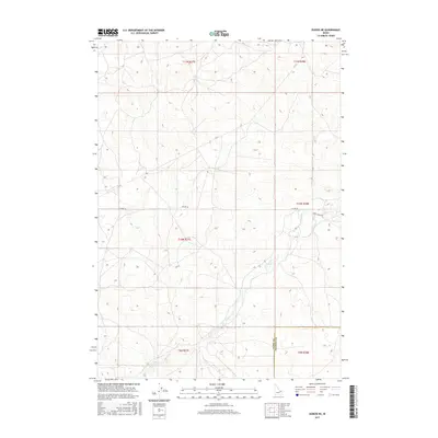
2017 Map of Dubois NE
USGS Topo · Published 2017About this map
Camas Cr meanders across this high-desert landscape near the Clark and Fremont County border, defining the primary drainage for the surrounding terrain. This 2017 edition illustrates a sparsely populated region of Idaho where land is organized by the Public Land Survey System, evidenced by the prominent grid lines of Township 10 North, Range 37 East and its neighbors. Human presence is primarily represented by a network of rural routes and ranch roads, including the well-defined Jacoby Rd and Gravy Ridge Rd, which provide access through the undulating topography. The map serves as a clear record of modern land management and hydrological patterns in this portion of the Snake River Plain hinterlands, showing how water and roads intersect in a working western landscape.
Find a feature on this map
11 named features on this map. Tap any name to fly to it.
Don’t see what you’re looking for? This feature index may not catch every label — zoom into the map to look around manually.
Map Details
Editions of this 2017 Dubois NE Map
This is the sole edition of this map. No revisions or reprints were ever made.
Other maps of this area

1955 · Dubois
USGS Topo · 1:250,000

1955 · Ashton
USGS Topo · 1:250,000

1958 · Dubois
USGS Topo · 1:250,000

1958 · Ashton
USGS Topo · 1:250,000

1960 · Ashton
USGS Topo · 1:250,000

1964 · Dubois NW
USGS Topo · 1:24,000

1964 · Dubois NE
USGS Topo · 1:24,000

1964 · Camas
USGS Topo · 1:24,000
1964 · Dubois SE
USGS Topo · 1:24,000

1972 · Spencer South
USGS Topo · 1:24,000