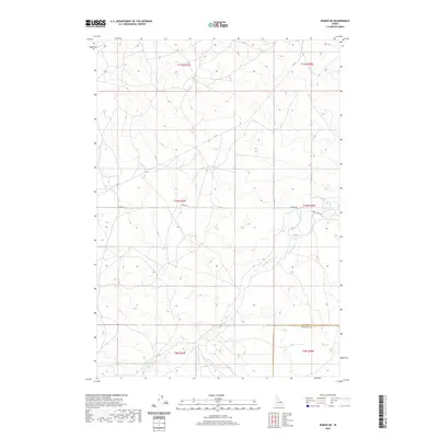
2020 Map of Dubois NE
USGS Topo · Published 2020About this map
Camas Cr meanders across this rural expanse in the northern reaches of the Snake River Plain, following a gentle drainage pattern that defines the local topography. This 2020 survey provides a precise layout of the Fremont County and Clark County boundary as it intersects the section lines of the Public Land Survey System. The landscape is characterized by a sparse network of backroads, including Jacoby Rd and the aptly named Gravy Ridge Rd, which provide access to the various townships. Mapping of this area, including t10n r37e and t11n r38e, reveals the persistent grid of western land management in a territory dominated by open terrain and seasonal watercourses.
Find a feature on this map
12 named features on this map. Tap any name to fly to it.
Don’t see what you’re looking for? This feature index may not catch every label — zoom into the map to look around manually.
Map Details
Editions of this 2020 Dubois NE Map
This is the sole edition of this map. No revisions or reprints were ever made.
Other maps of this area

1955 · Dubois
USGS Topo · 1:250,000

1955 · Ashton
USGS Topo · 1:250,000

1958 · Dubois
USGS Topo · 1:250,000

1958 · Ashton
USGS Topo · 1:250,000

1960 · Ashton
USGS Topo · 1:250,000

1964 · Dubois NW
USGS Topo · 1:24,000

1964 · Dubois NE
USGS Topo · 1:24,000

1964 · Camas
USGS Topo · 1:24,000
1964 · Dubois SE
USGS Topo · 1:24,000

1972 · Spencer South
USGS Topo · 1:24,000