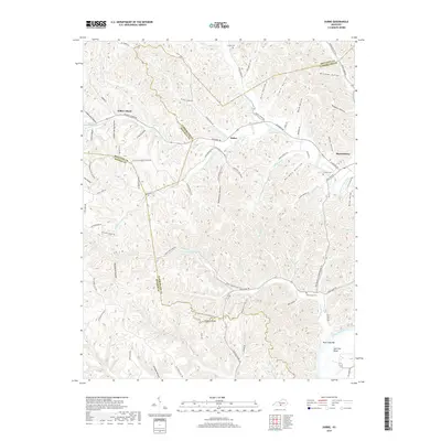
2019 Map of Dubre
USGS Topo · Published 2019About this map
Willow Shade and Dubre anchor this landscape where three Kentucky counties—Metcalfe, Cumberland, and Monroe—converge amidst a complex network of hollows and ridges. The terrain is deeply carved by the waters of Marrowbone Creek and Mud Camp Cr, which snake through the hills toward the Salt Lick Bend of the Cumberland River. This modern survey captures the legacy of local families and small-scale agriculture, evidenced by numerous named roads like Ham and Honey Rd and Richard Hammer Rd.
Find a feature on this map
91 named features on this map. Tap any name to fly to it.
Don’t see what you’re looking for? This feature index may not catch every label — zoom into the map to look around manually.
Map Details
Editions of this 2019 Dubre Map
This is the sole edition of this map. No revisions or reprints were ever made.
Other maps of this area

1924 · Lillydale
USGS Topo · 1:62,500

1926 · Lillydale
USGS Topo · 1:62,500

1929 · Lillydale
USGS Topo · 1:62,500

1929 · Tompkinsville
USGS Topo · 1:62,500

1953 · Sulphur Lick
USGS Topo · 1:24,000

1953 · Breeding
USGS Topo · 1:24,000

1953 · Waterview
USGS Topo · 1:24,000

1953 · Edmonton
USGS Topo · 1:24,000

1953 · Summer Shade
USGS Topo · 1:24,000

1953 · Dubre
USGS Topo · 1:24,000