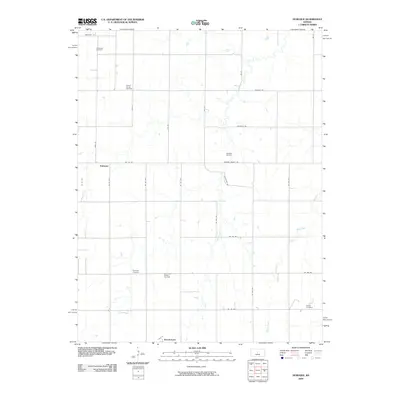
2009 Map of Dubuque
USGS Topo · Published 2009About this map
Dubuque and Hitschmann anchor this agricultural and industrial landscape in Barton County, recorded at a time when traditional farming and energy extraction coexisted across the plains. The terrain is defined by the drainage patterns of Coal Creek and Blood Creek, which wind through a grid of rural routes like Barton County Rd and NE 200 Rd. This survey captures the region's long-standing community centers, preserved through local landmarks such as Immanuel Cemetery, Dubuque Cemetery, and Bethel Cemetery.
Find a feature on this map
33 named features on this map. Tap any name to fly to it.
Don’t see what you’re looking for? This feature index may not catch every label — zoom into the map to look around manually.
Map Details
Editions of this 2009 Dubuque Map
This is the sole edition of this map. No revisions or reprints were ever made.
Other maps of this area

1894 · Ellsworth
USGS Topo · 1:125,000

1896 · Russell
USGS Topo · 1:125,000

1955 · Great Bend
USGS Topo · 1:250,000

1956 · Wilson
USGS Topo · 1:24,000

1956 · Dorrance
USGS Topo · 1:24,000

1956 · Dorrance SW
USGS Topo · 1:24,000

1957 · Great Bend
USGS Topo · 1:250,000

1958 · Great Bend
USGS Topo · 1:250,000
1964 · Holyrood NW
USGS Topo · 1:24,000
1964 · Holyrood
USGS Topo · 1:24,000