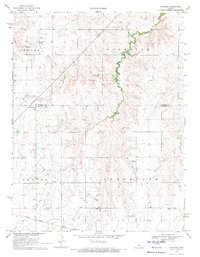
1969 Map of Dubuque
USGS Topo · Published 1971About this map
Dubuque sits at the intersection of the Russell Co Barton Co line, serving as a focal point in a landscape defined by the mid-century energy economy. The northern reaches of Barton County are heavily shaped by subterranean resources, with the extensive Driscoll Oil and Gas Field, Plymouth Oil and Gas Field, and Kraft-Prusa Oil and Gas Field marked by numerous oil wells and pipelines. This industrial footprint contrasts with the area's established rural community foundations, evidenced by the presence of Immanuel Cem, Dubuque Cem, and Bethel Cem. To the south, the settlement of Hitschmann is situated along the Atchison Topeka and Santa Fe railroad, which provides a primary transit corridor near the winding paths of Blood Creek and Coal Creek.
Find a feature on this map
15 named features on this map. Tap any name to fly to it.
Don’t see what you’re looking for? This feature index may not catch every label — zoom into the map to look around manually.
Map Details
Editions of this 1969 Dubuque Map
This is the sole edition of this map. No revisions or reprints were ever made.
Other maps of this area

1894 · Ellsworth
USGS Topo · 1:125,000

1896 · Russell
USGS Topo · 1:125,000

1955 · Great Bend
USGS Topo · 1:250,000

1956 · Wilson
USGS Topo · 1:24,000

1956 · Dorrance
USGS Topo · 1:24,000

1956 · Dorrance SW
USGS Topo · 1:24,000

1957 · Great Bend
USGS Topo · 1:250,000

1958 · Great Bend
USGS Topo · 1:250,000
1964 · Holyrood NW
USGS Topo · 1:24,000
1964 · Holyrood
USGS Topo · 1:24,000