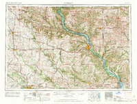
1962 Map of Dubuque
USGS Topo · Published 1962About this map
The Mississippi River valley anchors this mid-century survey, cutting through the high bluffs of the Tri-State area where Iowa, Wisconsin, and Illinois meet. The industrial and transit landscape is defined by the heavy presence of the Illinois Central and Chicago and North Western railroads, which connected the river hubs of Dubuque and Cedar Rapids to the mineral-rich uplands. Mineral extraction remains a visible legacy on this sheet, particularly the Numerous lead and zinc mines scattered across the Wisconsin side near Platteville.
Find a feature on this map
102 named features on this map. Tap any name to fly to it.
Don’t see what you’re looking for? This feature index may not catch every label — zoom into the map to look around manually.
Map Details
Editions of this 1962 Dubuque Map
2 editions found

Other maps of this area

1887 · Cedar Rapids
USGS Topo · 1:62,500

1888 · Shellsburg
USGS Topo · 1:62,500

1888 · Marion
USGS Topo · 1:62,500

1888 · Amana
USGS Topo · 1:62,500

1889 · Tipton
USGS Topo · 1:62,500

1889 · Marion
USGS Topo · 1:62,500

1889 · Amana
USGS Topo · 1:62,500

1889 · Shellsburg
USGS Topo · 1:62,500

1890 · Tipton
USGS Topo · 1:62,500

1890 · Anamosa
USGS Topo · 1:62,500