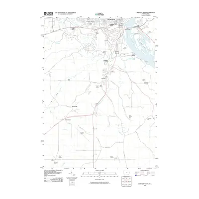
2010 Map of Dubuque South
USGS Topo · Published 2010About this map
Dubuque sits at a critical junction of the Mississippi River and its tributary system, where the landscape is defined by the winding paths of Catfish Creek and its north, middle, and south forks. This 2010 survey illustrates the southern expansion of the city toward Key West and Ballyclough, balanced against the preserved industrial and natural heritage near the river. Significant institutional footprints like the University of Dubuque and the Dubuque Regional Airport anchor the suburban and rural transition zones. The map is particularly dense with genealogical markers, featuring over a dozen burial sites including the Mines of Spain Cemetery and Saint Joseph of the Prairie Cemetery. From the riverfront infrastructure at Dubuque Harbor to the rugged terrain of Horseshoe Bluff, the sheet details the city's complex relationship with its bluffs and valleys.
Find a feature on this map
80 named features on this map. Tap any name to fly to it.
Don’t see what you’re looking for? This feature index may not catch every label — zoom into the map to look around manually.
Map Details
Editions of this 2010 Dubuque South Map
This is the sole edition of this map. No revisions or reprints were ever made.
Other maps of this area

1900 · Lancaster
USGS Topo · 1:125,000

1901 · Peosta
USGS Topo · 1:125,000

1904 · Lancaster
USGS Topo · 1:125,000

1908 · Lancaster
USGS Topo · 1:125,000

1935 · East Dubuque
USGS Topo · 1:62,500

1940 · East Dubuque
USGS Topo · 1:62,500

1955 · Menominee
USGS Topo · 1:24,000

1955 · Dubuque South
USGS Topo · 1:24,000

1956 · Dubuque North
USGS Topo · 1:24,000

1956 · Sherrill
USGS Topo · 1:24,000