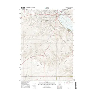
2015 Map of Dubuque South
USGS Topo · Published 2015About this map
Dubuque serves as a focal point along the western bank of the Mississippi River, where its urban landscape meets the complex drainage systems of Catfish Creek. The terrain is defined by dramatic elevation changes, notably at Kelly's Bluff and the Dubuque Hills, reflecting a landscape carved by the multiple forks of Catfish Creek. The map reveals a dense network of religious and educational institutions, including the University of Dubuque and the Wartburg Theological Seminary.
Find a feature on this map
45 named features on this map. Tap any name to fly to it.
Don’t see what you’re looking for? This feature index may not catch every label — zoom into the map to look around manually.
Map Details
Editions of this 2015 Dubuque South Map
This is the sole edition of this map. No revisions or reprints were ever made.
Other maps of this area

1900 · Lancaster
USGS Topo · 1:125,000

1901 · Peosta
USGS Topo · 1:125,000

1904 · Lancaster
USGS Topo · 1:125,000

1908 · Lancaster
USGS Topo · 1:125,000

1935 · East Dubuque
USGS Topo · 1:62,500

1940 · East Dubuque
USGS Topo · 1:62,500

1955 · Menominee
USGS Topo · 1:24,000

1955 · Dubuque South
USGS Topo · 1:24,000

1956 · Dubuque North
USGS Topo · 1:24,000

1956 · Sherrill
USGS Topo · 1:24,000