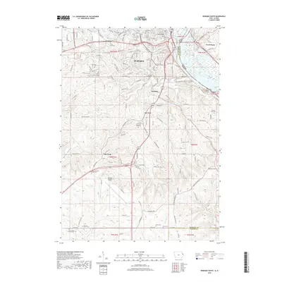
2018 Map of Dubuque South
USGS Topo · Published 2018About this map
Mississippi River frontage and the steep bluffs of eastern Iowa define this 2018 survey of the tri-state area. The city of Dubuque dominates the northern half of the map, connected to Illinois by the Julien Dubuque Bridge. The landscape transitions from the urban density of Center Grove and the residential corridors along NW Arterial to the expansive grounds of the Dubuque Regional Airport further south.
Find a feature on this map
180 named features on this map. Tap any name to fly to it.
Don’t see what you’re looking for? This feature index may not catch every label — zoom into the map to look around manually.
Map Details
Editions of this 2018 Dubuque South Map
This is the sole edition of this map. No revisions or reprints were ever made.
Other maps of this area

1900 · Lancaster
USGS Topo · 1:125,000

1901 · Peosta
USGS Topo · 1:125,000

1904 · Lancaster
USGS Topo · 1:125,000

1908 · Lancaster
USGS Topo · 1:125,000

1935 · East Dubuque
USGS Topo · 1:62,500

1940 · East Dubuque
USGS Topo · 1:62,500

1955 · Menominee
USGS Topo · 1:24,000

1955 · Dubuque South
USGS Topo · 1:24,000

1956 · Dubuque North
USGS Topo · 1:24,000

1956 · Sherrill
USGS Topo · 1:24,000