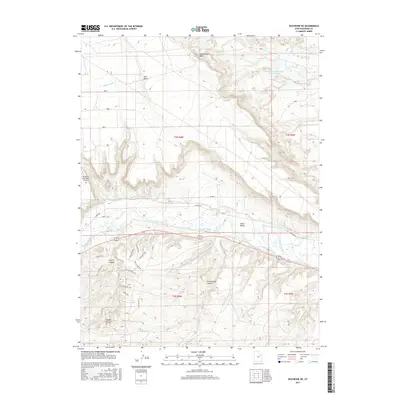
2017 Map of Duchesne NE
USGS Topo · Published 2017About this map
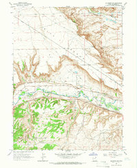
Irrigation infrastructure and rugged plateau geography define this 2017 survey of the northeastern outskirts of Duchesne. The Duchesne River valley serves as the central corridor for a complex network of waterways, including the Duchesne Feeder Canal, Gray Mountain Canal, and the tiered Rocky Point Canal system. To the north, the elevated Blue Bench dominates the landscape, featuring the Knight Ditch and Grant-Hansen Reservoir Number Three. The southern portion of the map is characterized by a series of deep drainages such as Coyote Canyon and Cottonwood Canyon. In the lower elevations, modern development is visible near the Duchesne Municipal Airport and along residential spurs like Big Buck Run Rd and Escalante Dr. This survey captures the vital relationship between the river and the surrounding arid high country, illustrating how water management has historically shaped land use in the Uinta Valley.
Find a feature on this map
32 named features on this map. Tap any name to fly to it.
Don’t see what you’re looking for? This feature index may not catch every label — zoom into the map to look around manually.
Map Details
Editions of this 2017 Duchesne NE Map
This is the sole edition of this map. No revisions or reprints were ever made.
Other maps of this area

1885 · Uinta
USGS Topo · 1:250,000

1939 · Duchesne
USGS Topo · 1:125,000

1954 · Salt Lake City
USGS Topo · 1:250,000

1958 · Salt Lake City
USGS Topo · 1:250,000

1960 · Salt Lake City
USGS Topo · 1:250,000
1964 · Duchesne SE
USGS Topo · 1:24,000
1964 · Myton SW
USGS Topo · 1:24,000
1964 · Duchesne SW
USGS Topo · 1:24,000
1964 · Duchesne NE
USGS Topo · 1:24,000
1964 · Bridgeland
USGS Topo · 1:24,000