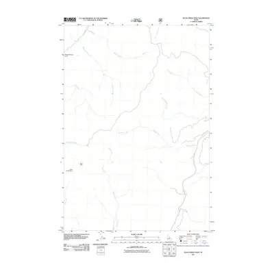
2011 Map of Duck Creek Point
USGS Topo · Published 2011About this map
Duck Peak and the high vantage of Duck Creek Point anchor this remote section of the Salmon River Mountains. The landscape is defined by an intricate network of drainages that feed into larger western Idaho water systems. From the north, Yellowjacket Creek and Beagle Creek carve through the terrain, while the eastern portion of the map is dominated by the long course of Silver Creek. These waterways, including the descriptively named Slaughterhouse Gulch and Fourth of July Creek, trace the natural pathways through a region largely devoid of permanent settlements or major infrastructure. The prevalence of named forks and small tributaries like South Fork Cabin Creek and Rams Creek provides a high level of detail for those navigating the high country or researching local geographical nomenclature in Lemhi County.
Find a feature on this map
15 named features on this map. Tap any name to fly to it.
Don’t see what you’re looking for? This feature index may not catch every label — zoom into the map to look around manually.
Map Details
Editions of this 2011 Duck Creek Point Map
This is the sole edition of this map. No revisions or reprints were ever made.
Other maps of this area

1930 · Casto
USGS Topo · 1:125,000

1950 · Blackbird Mtn
USGS Topo · 1:62,500

1951 · Blackbird Mtn
USGS Topo · 1:62,500

1956 · Elk City
USGS Topo · 1:250,000

1957 · Challis
USGS Topo · 1:250,000

1960 · Elk City
USGS Topo · 1:250,000

1960 · Challis
USGS Topo · 1:250,000

1962 · Hoodoo Meadows
USGS Topo · 1:24,000

1963 · Challis
USGS Topo · 1:250,000

1963 · Meyers Cove
USGS Topo · 1:24,000