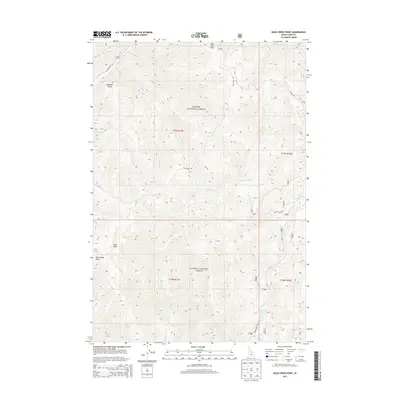
2013 Map of Duck Creek Point
USGS Topo · Published 2013About this map
Salmon National Forest defines the landscape of this Lemhi County quadrangle, where the high-altitude terrain of the Salmon River Mountains is meticulously recorded. The map centers on the namesake Duck Creek Point, a prominent overlook in a network of drainage systems including Beagle Cr, Yellowjacket Cr, and Birdseye Cr. Access to this high country is marked by winding primitive routes like Duck Peak Rd and Yellowjacket Rd, which follow the natural contours of the land. High points such as Duck Peak and Red Rock Peak dominate the topography, providing critical landmarks for navigation. This 2013 survey serves as a precise record of the road and stream networks before modern environmental changes, including the complex headwaters of Cabin Creek and the isolated drainage of Anderson Gulch.
Find a feature on this map
26 named features on this map. Tap any name to fly to it.
Don’t see what you’re looking for? This feature index may not catch every label — zoom into the map to look around manually.
Map Details
Editions of this 2013 Duck Creek Point Map
This is the sole edition of this map. No revisions or reprints were ever made.
Other maps of this area

1930 · Casto
USGS Topo · 1:125,000

1950 · Blackbird Mtn
USGS Topo · 1:62,500

1951 · Blackbird Mtn
USGS Topo · 1:62,500

1956 · Elk City
USGS Topo · 1:250,000

1957 · Challis
USGS Topo · 1:250,000

1960 · Elk City
USGS Topo · 1:250,000

1960 · Challis
USGS Topo · 1:250,000

1962 · Hoodoo Meadows
USGS Topo · 1:24,000

1963 · Challis
USGS Topo · 1:250,000

1963 · Meyers Cove
USGS Topo · 1:24,000