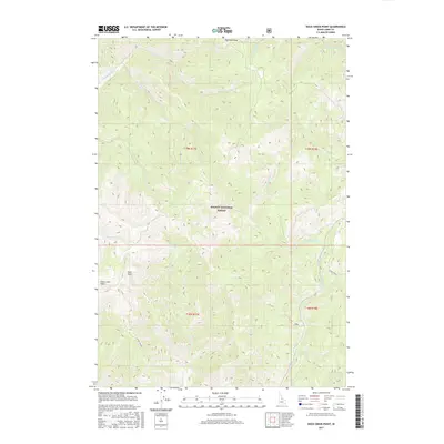
2017 Map of Duck Creek Point
USGS Topo · Published 2017About this map
Salmon National Forest defines this high-elevation landscape in Lemhi County, where the terrain is carved by an intricate network of alpine drainages. Significant landmarks such as Red Rock Peak and Duck Peak provide high-ground orientation for the region, while Duck Creek Point overlooks the watersheds of the Salmon River mountains. The map illustrates a complex hydraulic system including Yellowjacket Cr, Beagle Cr, and the appropriately named Fourth of July Cr. Historical land management and property lines are visible through township and range boundaries like t19n r17e and t19n r18e. This 2017 survey details the remote backcountry of central Idaho, documenting the precise courses of Silver Creek and Little Jacket creek during a period of modern forest administration.
Find a feature on this map
23 named features on this map. Tap any name to fly to it.
Don’t see what you’re looking for? This feature index may not catch every label — zoom into the map to look around manually.
Map Details
Editions of this 2017 Duck Creek Point Map
This is the sole edition of this map. No revisions or reprints were ever made.
Other maps of this area

1930 · Casto
USGS Topo · 1:125,000

1950 · Blackbird Mtn
USGS Topo · 1:62,500

1951 · Blackbird Mtn
USGS Topo · 1:62,500

1956 · Elk City
USGS Topo · 1:250,000

1957 · Challis
USGS Topo · 1:250,000

1960 · Elk City
USGS Topo · 1:250,000

1960 · Challis
USGS Topo · 1:250,000

1962 · Hoodoo Meadows
USGS Topo · 1:24,000

1963 · Challis
USGS Topo · 1:250,000

1963 · Meyers Cove
USGS Topo · 1:24,000