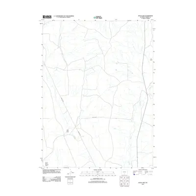
2012 Map of Duck Lake
USGS Topo · Published 2012About this map
Duck Lake serves as a focal point for this high-desert basin in Carbon County, situated within a network of ephemeral drainages and notable terrain features. The landscape is defined by the carved paths of Antelope Cr and Muddy Cr, which intersect the dry expanses characteristic of this part of the Wyoming plateau. Remote access is provided by the junction of Wamsutter Rd and Duck Lake Rd, highlighting the sparse but essential transportation network that serves the region's energy and ranching interests. Distinctive landforms such as Pine Butte, Little Coal Gulch, and the curiously named North Barrel Springs Draw illustrate the geological character of the area, where water sources and elevation changes have long dictated movement across the sagebrush steppe.
Find a feature on this map
8 named features on this map. Tap any name to fly to it.
Don’t see what you’re looking for? This feature index may not catch every label — zoom into the map to look around manually.
Map Details
Editions of this 2012 Duck Lake Map
This is the sole edition of this map. No revisions or reprints were ever made.
Other maps of this area

1954 · Rawlins
USGS Topo · 1:250,000

1957 · Doty Mountain
USGS Topo · 1:62,500

1958 · Rawlins
USGS Topo · 1:250,000

1962 · Rawlins
USGS Topo · 1:250,000

1966 · Seaverson Reservoir
USGS Topo · 1:24,000

1966 · High Point
USGS Topo · 1:24,000

1966 · Eightmile Lake
USGS Topo · 1:24,000

1967 · Rawlins
USGS Topo · 1:250,000

1970 · South Barrel Spring
USGS Topo · 1:24,000

1970 · Mexican Flats
USGS Topo · 1:24,000