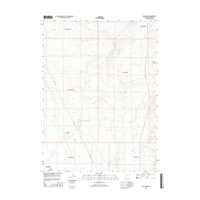
2015 Map of Duck Lake
USGS Topo · Published 2015About this map
Duck Lake serves as a central focal point in this high-desert region of Carbon County, where the landscape is defined by drainage patterns and arid terrain. This 2015 survey illustrates a network of seasonal watercourses and topographic landmarks that have guided movement through the area for generations, including the prominent Pine Butte and the carved path of Little Coal Gulch. The map reveals the functional infrastructure of the contemporary West, where historic township boundaries like t17n r92w and t17n r93w intersect with utilitarian transit routes such as Wam Sutter Rd. Water, always a critical resource in the Wyoming basins, is traced through the winding courses of Muddy Cr and Antelope Cr, providing a clear view of the natural hydrology that dictates the distribution of life and land use across these public and private lands.
Find a feature on this map
15 named features on this map. Tap any name to fly to it.
Don’t see what you’re looking for? This feature index may not catch every label — zoom into the map to look around manually.
Map Details
Editions of this 2015 Duck Lake Map
This is the sole edition of this map. No revisions or reprints were ever made.
Other maps of this area

1954 · Rawlins
USGS Topo · 1:250,000

1957 · Doty Mountain
USGS Topo · 1:62,500

1958 · Rawlins
USGS Topo · 1:250,000

1962 · Rawlins
USGS Topo · 1:250,000

1966 · Seaverson Reservoir
USGS Topo · 1:24,000

1966 · High Point
USGS Topo · 1:24,000

1966 · Eightmile Lake
USGS Topo · 1:24,000

1967 · Rawlins
USGS Topo · 1:250,000

1970 · South Barrel Spring
USGS Topo · 1:24,000

1970 · Mexican Flats
USGS Topo · 1:24,000