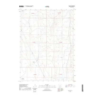
2017 Map of Duck Lake
USGS Topo · Published 2017About this map
Duck Lake sits at the heart of this high-altitude Carbon County landscape, a seasonal water feature in an arid expanse defined by deep erosional cuts and drainage networks. The terrain is marked by significant topographical landmarks such as Pine Butte in the northeast and a series of rugged draws including Coal Gulch, Little Coal Gulch, and North Barrel Springs Draw to the southwest. This 2017 survey illustrates the sparse but essential transportation infrastructure of the Red Desert region, primarily centered on the intersection of Wamsutter Rd and Duck Lake Rd. The map detail captures the intersection of several townships, including t17n r93w, where ephemeral watercourses like Antelope Cr and Muddy Cr dictate the natural flow of the land. These features provide critical spatial context for researchers studying the geography of Wyoming's basin lands or tracing early transit corridors through the county.
Find a feature on this map
15 named features on this map. Tap any name to fly to it.
Don’t see what you’re looking for? This feature index may not catch every label — zoom into the map to look around manually.
Map Details
Editions of this 2017 Duck Lake Map
This is the sole edition of this map. No revisions or reprints were ever made.
Other maps of this area

1954 · Rawlins
USGS Topo · 1:250,000

1957 · Doty Mountain
USGS Topo · 1:62,500

1958 · Rawlins
USGS Topo · 1:250,000

1962 · Rawlins
USGS Topo · 1:250,000

1966 · Seaverson Reservoir
USGS Topo · 1:24,000

1966 · High Point
USGS Topo · 1:24,000

1966 · Eightmile Lake
USGS Topo · 1:24,000

1967 · Rawlins
USGS Topo · 1:250,000

1970 · South Barrel Spring
USGS Topo · 1:24,000

1970 · Mexican Flats
USGS Topo · 1:24,000