
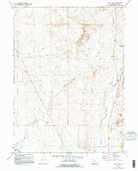
1970 Map of Duck Lake
USGS Topo · Published 1973About this map
The Overland Trail cuts across this high desert landscape, marked by a Historical Marker that stands near the eastern edge of the quadrangle. This 1970 field-checked survey reveals a region defined by complex drainage systems and energy exploration, evidenced by scattered Drill Hole locations and a Well near the southern boundary. The terrain is dominated by arroyos and gulches, including Coal Gulch and Little Coal Gulch, which feed into the more prominent Muddy Creek.
Find a feature on this map
12 named features on this map. Tap any name to fly to it.
Don’t see what you’re looking for? This feature index may not catch every label — zoom into the map to look around manually.
Map Details
Editions of this 1970 Duck Lake Map
2 editions found
Other maps of this area

1954 · Rawlins
USGS Topo · 1:250,000

1957 · Doty Mountain
USGS Topo · 1:62,500

1958 · Rawlins
USGS Topo · 1:250,000

1962 · Rawlins
USGS Topo · 1:250,000

1966 · Seaverson Reservoir
USGS Topo · 1:24,000

1966 · High Point
USGS Topo · 1:24,000

1966 · Eightmile Lake
USGS Topo · 1:24,000

1967 · Rawlins
USGS Topo · 1:250,000

1970 · South Barrel Spring
USGS Topo · 1:24,000

1970 · Mexican Flats
USGS Topo · 1:24,000