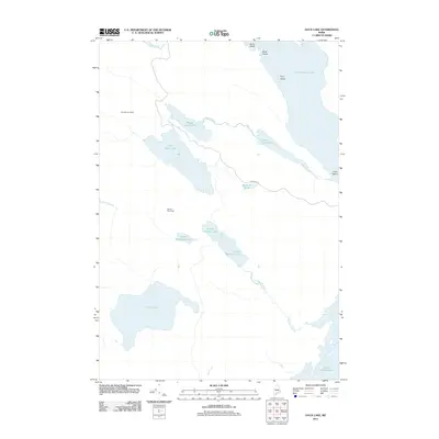
2011 Map of Duck Lake
USGS Topo · Published 2011About this map
Duck Lake and the interconnected waterways of the Downeast interior define this landscape in the early twenty-first century. The map reveals a complex hydrographic network, where Chain Stream links the Upper Chain Lake, Middle Chain Lake, and Lower Chain Lake. Evidence of the region's logging and sporting heritage is found at remote outposts like Number Six Camp and Number Two Camp, accessed by primitive routes such as Wabassus Rd. To the northeast, the expansive Sysladobsis Lake contains several named landforms, including Pine Island and Birch Island. The southern reaches of the quadrangle transition into the Machias River watershed via Unknown Stream and its namesake chain of lakes, including Upper Unknown Lake and Lower Unknown Lake, eventually reaching the shores of Fourth Machias Lake.
Find a feature on this map
21 named features on this map. Tap any name to fly to it.
Don’t see what you’re looking for? This feature index may not catch every label — zoom into the map to look around manually.
Map Details
Editions of this 2011 Duck Lake Map
This is the sole edition of this map. No revisions or reprints were ever made.
Other maps of this area

1931 · Springfield
USGS Topo · 1:48,000

1932 · Nicatous Lake
USGS Topo · 1:48,000

1934 · Nicatous Lake
USGS Topo · 1:62,500

1934 · Springfield
USGS Topo · 1:62,500

1941 · Scraggly Lake
USGS Topo · 1:62,500

1941 · Wabassus Lake
USGS Topo · 1:62,500

1943 · Wabassus Lake
USGS Topo · 1:62,500

1944 · Scraggly Lake
USGS Topo · 1:62,500

1953 · Wabassus Lake
USGS Topo · 1:62,500

1954 · Millinocket
USGS Topo · 1:250,000