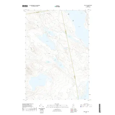
2021 Map of Duck Lake
USGS Topo · Published 2021About this map
The vast interconnected waterways of the Downeast interior dominate this landscape where the boundaries of Penobscot, Hancock, and Washington counties converge. Centered on the sprawling Duck Lake, the map traces a complex network of glacial lakes and streams including the Chain Lake series—Upper Chain Lake, Middle Chain Lake, and Lower Chain Lake—which are linked by the winding Chain Stream. To the south, the "Unknown" chain of lakes drains via Unknown Stream toward Fourth Machias Lake, illustrating the intricate drainage patterns of this timber-rich region.
Find a feature on this map
25 named features on this map. Tap any name to fly to it.
Don’t see what you’re looking for? This feature index may not catch every label — zoom into the map to look around manually.
Map Details
Editions of this 2021 Duck Lake Map
This is the sole edition of this map. No revisions or reprints were ever made.
Other maps of this area

1931 · Springfield
USGS Topo · 1:48,000

1932 · Nicatous Lake
USGS Topo · 1:48,000

1934 · Nicatous Lake
USGS Topo · 1:62,500

1934 · Springfield
USGS Topo · 1:62,500

1941 · Scraggly Lake
USGS Topo · 1:62,500

1941 · Wabassus Lake
USGS Topo · 1:62,500

1943 · Wabassus Lake
USGS Topo · 1:62,500

1944 · Scraggly Lake
USGS Topo · 1:62,500

1953 · Wabassus Lake
USGS Topo · 1:62,500

1954 · Millinocket
USGS Topo · 1:250,000