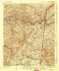
1943 Map of Ducktown
USGS Topo · Published 1943About this map
Copper mining operations dominate the southern portion of this landscape, centered on the historic district of Ducktown. Industrial sites like the Burra Burra Mine, Eureka Mine, and the London Flotation Plant illustrate the scale of the local economy during the mid-20th century. The Louisville and Nashville Railroad winds through the hills, connecting mining centers with smaller settlements like Isabella, Postelle, and Turtletown.
Find a feature on this map
122 named features on this map. Tap any name to fly to it.
Don’t see what you’re looking for? This feature index may not catch every label — zoom into the map to look around manually.
Map Details
Editions of this 1943 Ducktown Map
2 editions found
Other maps of this area

1886 · Dalton
USGS Topo · 1:125,000

1886 · Cleveland
USGS Topo · 1:125,000

1888 · Ellijay
USGS Topo · 1:125,000

1892 · Cleveland
USGS Topo · 1:125,000

1892 · Ellijay
USGS Topo · 1:125,000

1892 · Dalton
USGS Topo · 1:125,000

1893 · Murphy
USGS Topo · 1:125,000

1895 · Cleveland
USGS Topo · 1:125,000

1897 · Dalton
USGS Topo · 1:125,000

1898 · Ellijay
USGS Topo · 1:125,000