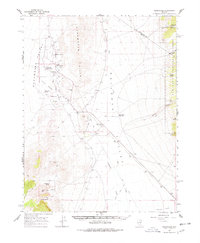
1964 Map of Duckwater
USGS Topo · Published 1978About this map
Duckwater (Agency Hdqrs) serves as the central hub of this Great Basin landscape, situated within the Duckwater Valley where water sources dictate the patterns of life. The 1960s survey captures the area's reliance on thermal and cold water features, notably Big Warm Spring and Little Warm Spring, which support the local agriculture and the Duckwater community. Cultural landmarks like the Duckwater Sch and multiple burial sites including Duckwater Cem and a lonely Grave near Old Collins Spring provide significant touchpoints for genealogists.
Find a feature on this map
38 named features on this map. Tap any name to fly to it.
Don’t see what you’re looking for? This feature index may not catch every label — zoom into the map to look around manually.
Map Details
Editions of this 1964 Duckwater Map
2 editions found

Other maps of this area

1949 · Treasure Hill
USGS Topo · 1:62,500

1950 · Treasure Hill
USGS Topo · 1:62,500

1951 · Green Springs
USGS Topo · 1:62,500

1956 · Lund
USGS Topo · 1:250,000

1956 · Ely
USGS Topo · 1:250,000

1957 · Currant Mtn
USGS Topo · 1:62,500

1959 · Ely
USGS Topo · 1:250,000

1960 · Lund
USGS Topo · 1:250,000

1963 · Ely
USGS Topo · 1:250,000

1964 · Blue Eagle Springs
USGS Topo · 1:62,500