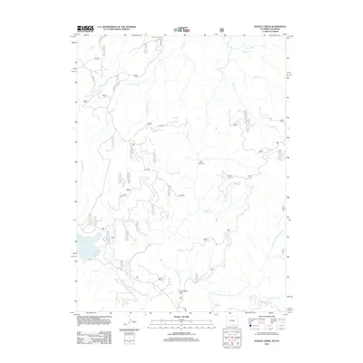
2012 Map of Dudley Creek
USGS Topo · Published 2012About this map
Hog Park Reservoir dominates the southwest corner of this high-elevation landscape, where the waters of Hog Park Cr and Sams Cr are gathered at the edge of the Continental Divide region. This 2012 survey documents a rugged hydraulic and transport network characterized by Forest Service access roads and clear mountain drainage systems. The Encampment River and its tributary, the E Fork Encampment River, carve through the eastern half of the quadrangle, passing through sites like Commissary Park. Localized landmarks such as Finch Cow Camp and the geological formation of Box Canyon indicate the area's history of seasonal grazing and wilderness management. A dense network of drainage creeks, including N Soldier Cr, S Soldier Cr, and Dudley Cr, feed into the river system, illustrating the complex watershed of the Medicine Bow-Routt National Forest area.
Find a feature on this map
64 named features on this map. Tap any name to fly to it.
Don’t see what you’re looking for? This feature index may not catch every label — zoom into the map to look around manually.
Map Details
Editions of this 2012 Dudley Creek Map
This is the sole edition of this map. No revisions or reprints were ever made.
Other maps of this area

1911 · Hahns Peak
USGS Topo · 1:125,000

1913 · Hahns Peak
USGS Topo · 1:125,000

1939 · Saratoga
USGS Topo · 1:125,000

1954 · Rawlins
USGS Topo · 1:250,000

1954 · Craig
USGS Topo · 1:250,000

1955 · Davis Peak
USGS Topo · 1:24,000

1956 · Pearl
USGS Topo · 1:62,500

1957 · Craig
USGS Topo · 1:250,000

1958 · Rawlins
USGS Topo · 1:250,000

1958 · Craig
USGS Topo · 1:250,000