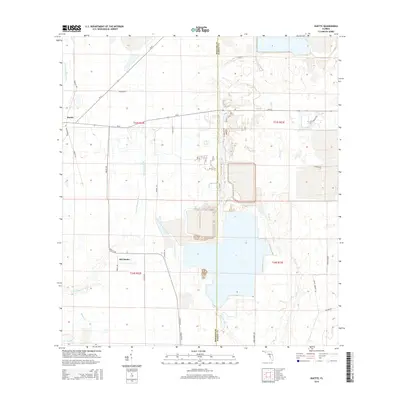
2015 Map of Duette
USGS Topo · Published 2015About this map
Duette and Old Duette anchor this section of the Florida interior, where the headwaters of the Manatee River and Horse Creek systems converge. The landscape is defined by the winding paths of the N Fork Manatee River and the E Fork Manatee River to the west, while the eastern portion is dominated by the West Fork Horse Creek and Horse Cr drainage basins. This area along the Manatee and Hardee County line shows a transition from agricultural land to large-scale industrial surface features, particularly the large impoundments and modified terrain visible south of SR-62. A network of rural routes, including Duette Rd and Sidney Roberts Rd, connects these remote settlements and industrial sites, providing a clear record of the region's 21st-century land use and water management infrastructure.
Find a feature on this map
31 named features on this map. Tap any name to fly to it.
Don’t see what you’re looking for? This feature index may not catch every label — zoom into the map to look around manually.
Map Details
Editions of this 2015 Duette Map
This is the sole edition of this map. No revisions or reprints were ever made.
Other maps of this area

1955 · Ft. Green
USGS Topo · 1:24,000

1955 · Baird
USGS Topo · 1:24,000

1956 · Ona
USGS Topo · 1:24,000

1956 · Myakka City NW
USGS Topo · 1:24,000

1956 · Ft Lonesome
USGS Topo · 1:24,000

1956 · Myakka Head
USGS Topo · 1:24,000

1956 · Duette NE
USGS Topo · 1:24,000

1956 · Duette
USGS Topo · 1:24,000

1956 · Keentown
USGS Topo · 1:24,000

1956 · Tampa
USGS Topo · 1:250,000