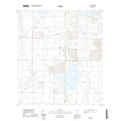
2021 Map of Duette
USGS Topo · Published 2021About this map
The settlement of Duette sits at the intersection of rural thoroughfares in eastern Manatee County, where agriculture and conservation lands dominate the landscape. This area is defined by the complex hydrology of the Florida interior, featuring the N Fork Manatee River and the S Fork Manatee River, alongside significant tributaries like Horse Cr and the W Fork Horse Cr. Large-scale land use patterns are evident in the sprawling public spaces, with recreation and resource management highlighted by the Duette Park Trl and the Headwaters At Duette Park Trl. Local family history is etched into the road network, which includes Owen Roberts Rd, Sidney Roberts Rd, and McLeod Rd, marking the generational influence of ranching and farming families along the Manatee and Hardee County line.
Find a feature on this map
28 named features on this map. Tap any name to fly to it.
Don’t see what you’re looking for? This feature index may not catch every label — zoom into the map to look around manually.
Map Details
Editions of this 2021 Duette Map
This is the sole edition of this map. No revisions or reprints were ever made.
Other maps of this area

1955 · Ft. Green
USGS Topo · 1:24,000

1955 · Baird
USGS Topo · 1:24,000

1956 · Ona
USGS Topo · 1:24,000

1956 · Myakka City NW
USGS Topo · 1:24,000

1956 · Ft Lonesome
USGS Topo · 1:24,000

1956 · Myakka Head
USGS Topo · 1:24,000

1956 · Duette NE
USGS Topo · 1:24,000

1956 · Duette
USGS Topo · 1:24,000

1956 · Keentown
USGS Topo · 1:24,000

1956 · Tampa
USGS Topo · 1:250,000