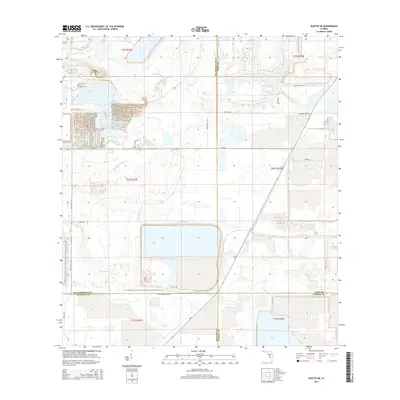
2015 Map of Duette NE
USGS Topo · Published 2015About this map
Industrial land use and natural hydrology meet at the intersection of four Florida counties: Hillsborough, Manatee, Polk, and Hardee. The landscape is defined by the winding course of the S Prong Alafia River in the north and the headwaters of the Little Manatee River to the south. Large-scale earthworks and reservoirs dominate the central and southern sections of the map, particularly near Four Corners Mine Rd, reflecting the area's history with phosphate mining operations. A grid of rural roads, including Earl Reynolds Rd and Taylor Gill Rd, provides access to these remote tracts. Tributaries like Alderman Cr, Boggy Br, and Lake Br thread through the terrain, illustrating the complex drainage patterns of this central Florida region during the mid-2010s.
Find a feature on this map
26 named features on this map. Tap any name to fly to it.
Don’t see what you’re looking for? This feature index may not catch every label — zoom into the map to look around manually.
Map Details
Editions of this 2015 Duette NE Map
This is the sole edition of this map. No revisions or reprints were ever made.
Other maps of this area

1949 · Bradley Junction
USGS Topo · 1:24,000

1950 · Bradley Junction
USGS Topo · 1:24,000

1955 · Lithia
USGS Topo · 1:24,000

1955 · Ft. Green
USGS Topo · 1:24,000

1955 · Baird
USGS Topo · 1:24,000

1955 · Keysville
USGS Topo · 1:24,000

1956 · Ft Lonesome
USGS Topo · 1:24,000

1956 · Duette NE
USGS Topo · 1:24,000

1956 · Duette
USGS Topo · 1:24,000

1956 · Keentown
USGS Topo · 1:24,000