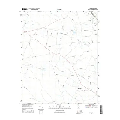
2014 Map of Duford
USGS Topo · Published 2014About this map
The Lumber Rvr corridor and the Lowcountry plains of Horry County dominate this landscape, where small agricultural communities and family-named cemeteries are scattered among the many creeks and ponds. The settlement of Duford serves as a central point, situated along the crossroads of SC-9 and SC-19, surrounded by family landmarks such as Soules Cem and Mears Pond. Further west, Floyds Crossroads sits near the riverbanks of Boggy Br and the Riverside Cem.
Find a feature on this map
115 named features on this map. Tap any name to fly to it.
Don’t see what you’re looking for? This feature index may not catch every label — zoom into the map to look around manually.
Map Details
Editions of this 2014 Duford Map
This is the sole edition of this map. No revisions or reprints were ever made.
Other maps of this area

1943 · Pages Mill
USGS Topo · 1:62,500

1948 · Galivants Ferry
USGS Topo · 1:24,000

1948 · Nichols
USGS Topo · 1:24,000

1948 · Bayboro
USGS Topo · 1:24,000

1949 · Bayboro
USGS Topo · 1:24,000

1949 · Duford
USGS Topo · 1:24,000

1950 · Galivants Ferry
USGS Topo · 1:24,000

1950 · Nichols
USGS Topo · 1:24,000

1953 · Chadbourn
USGS Topo · 1:62,500

1953 · Florence
USGS Topo · 1:250,000