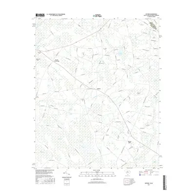
2017 Map of Duford
USGS Topo · Published 2017About this map
Floyds Crossroads and Duford serve as central nodes for this rural stretch of Horry County along the North Carolina border. The landscape is defined by its complex hydrography, where numerous Carolina bays such as Gray Bay, Mossy Bay, and Fifteenmile Bay are interspersed with low-lying swamps and creeks. This 2017 survey reveals the enduring agricultural and residential patterns of the region, anchored by historical family burial grounds including Hook Cem, Riverside Cem, and Soules Cem. The intersection of State Hwy 430 and Duford Rd marks the center of local activity, while Green Sea Airport and the community of Mount Olive anchor the southeastern portion. The presence of Bear Sand Ridges in the northwest highlights the subtle but distinct geological variations that have influenced settlement and drainage in this coastal plain environment for generations.
Find a feature on this map
116 named features on this map. Tap any name to fly to it.
Don’t see what you’re looking for? This feature index may not catch every label — zoom into the map to look around manually.
Map Details
Editions of this 2017 Duford Map
This is the sole edition of this map. No revisions or reprints were ever made.
Other maps of this area

1943 · Pages Mill
USGS Topo · 1:62,500

1948 · Galivants Ferry
USGS Topo · 1:24,000

1948 · Nichols
USGS Topo · 1:24,000

1948 · Bayboro
USGS Topo · 1:24,000

1949 · Bayboro
USGS Topo · 1:24,000

1949 · Duford
USGS Topo · 1:24,000

1950 · Galivants Ferry
USGS Topo · 1:24,000

1950 · Nichols
USGS Topo · 1:24,000

1953 · Chadbourn
USGS Topo · 1:62,500

1953 · Florence
USGS Topo · 1:250,000