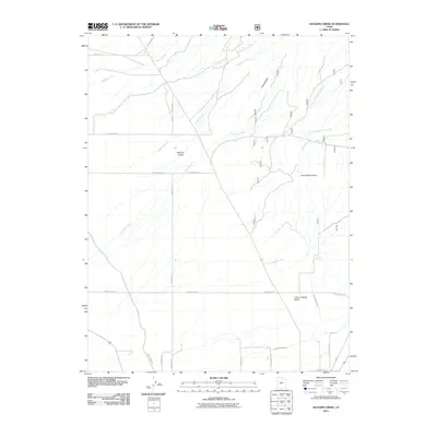
2011 Map of Duggins Creek
USGS Topo · Published 2011About this map
Pahvant Valley and the Church Mountains define this section of Millard County, where the transition from high desert peaks to agricultural basin is clearly marked by a network of seasonal watercourses and man-made irrigation. The landscape is dominated by the drainage systems of Duggins Creek and Eightmile Creek, which flow toward the valley floor from the rugged eastern heights. The reliance on water management in this arid environment is evident in the presence of the Central Utah Canal in the southwest and the Church Spring Ditch, which redirects flow from Church Spring. A grid of rural roads, including W 11700 North St and N 400 West St, provides the primary structure for the scattered settlements and ranching operations that characterize the area's development into the early 21st century.
Find a feature on this map
25 named features on this map. Tap any name to fly to it.
Don’t see what you’re looking for? This feature index may not catch every label — zoom into the map to look around manually.
Map Details
Editions of this 2011 Duggins Creek Map
This is the sole edition of this map. No revisions or reprints were ever made.
Other maps of this area

1885 · Sevier Desert
USGS Topo · 1:250,000

1951 · Oak City
USGS Topo · 1:62,500

1952 · Scipio North
USGS Topo · 1:62,500

1953 · Delta
USGS Topo · 1:250,000

1958 · Delta
USGS Topo · 1:250,000

1962 · Delta
USGS Topo · 1:250,000
1962 · The Sink
USGS Topo · 1:24,000
1962 · Holden
USGS Topo · 1:24,000

1962 · Holden
USGS Topo · 1:62,500
1969 · Scipio Pass
USGS Topo · 1:24,000