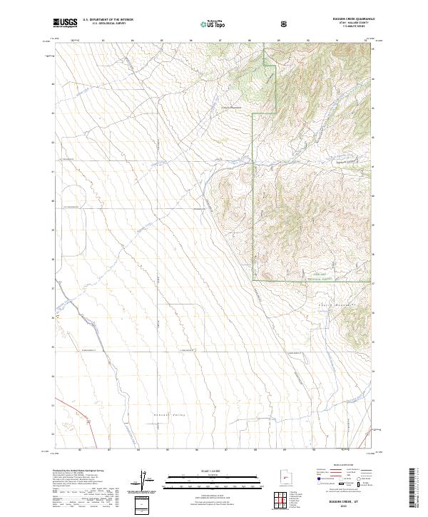
2023 Map of Duggins Creek
USGS Topo · Published 2023About this map
Pahvant Valley sits at the foot of the Canyon Mountains in Millard County, where the desert floor meets the high timber of the Fishlake National Forest. Water management is the primary theme of this landscape, evidenced by the Central Utah Canal and intricate drainage systems like Church Spring Ditch and East Fork Ditch that feed the agricultural land. The transition from the rugged Canyon Mountains down into the flats is marked by seasonal drainages such as Duggins Creek and Whisky Creek. Local ranchers and outdoorsmen would recognize landmarks like Coyote Spring and Church Spring, which provide vital water points in this arid environment. The map also traces various access routes including Whiskey Creek Rd and several backcountry trails like the Duggins Trl, which navigate the steep terrain of Long Canyon.
Find a feature on this map
29 named features on this map. Tap any name to fly to it.
Don’t see what you’re looking for? This feature index may not catch every label — zoom into the map to look around manually.
Map Details
Editions of this 2023 Duggins Creek Map
This is the sole edition of this map. No revisions or reprints were ever made.
Other maps of this area

1885 · Sevier Desert
USGS Topo · 1:250,000

1951 · Oak City
USGS Topo · 1:62,500

1952 · Scipio North
USGS Topo · 1:62,500

1953 · Delta
USGS Topo · 1:250,000

1958 · Delta
USGS Topo · 1:250,000

1962 · Delta
USGS Topo · 1:250,000
1962 · The Sink
USGS Topo · 1:24,000
1962 · Holden
USGS Topo · 1:24,000

1962 · Holden
USGS Topo · 1:62,500
1969 · Scipio Pass
USGS Topo · 1:24,000