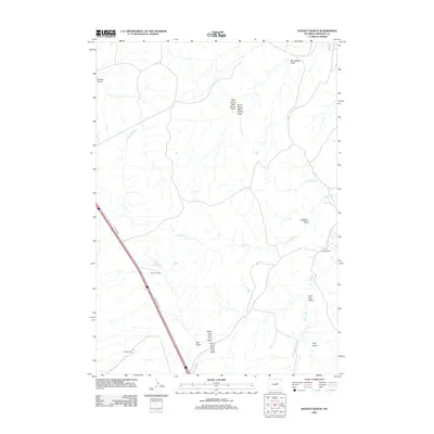
2012 Map of Dugout Ranch
USGS Topo · Published 2012About this map
Dugout Ranch and other family holdings define the drainage-scored landscape of Johnson County in this early 21st-century study. The terrain is characterized by an intricate network of intermittent waterways, including the winding Crooked Cr and the complex forks of Lone Tree Gulch. Evidence of long-standing ranching operations is visible at O'Conner Ranch and Hull Ranch, positioned near crucial water sources like Quinn Reservoir.
Find a feature on this map
19 named features on this map. Tap any name to fly to it.
Don’t see what you’re looking for? This feature index may not catch every label — zoom into the map to look around manually.
Map Details
Editions of this 2012 Dugout Ranch Map
This is the sole edition of this map. No revisions or reprints were ever made.
Other maps of this area

1955 · Arminto
USGS Topo · 1:250,000

1958 · Arminto
USGS Topo · 1:250,000

1961 · Kaycee NE
USGS Topo · 1:24,000

1961 · Figure 8 Reservoir
USGS Topo · 1:24,000

1961 · Dugout Ranch
USGS Topo · 1:24,000

1961 · Dead Woman Crossing
USGS Topo · 1:24,000

1961 · Wall Creek
USGS Topo · 1:24,000
1961 · Sussex
USGS Topo · 1:24,000

1962 · Arminto
USGS Topo · 1:250,000

1968 · Midwest
USGS Topo · 1:24,000