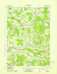
1943 Map of Dugway
USGS Topo · Published 1943About this map
Happy Valley Game Management Area dominates the eastern portion of this Oswego County landscape, which is characterized by a dense network of rural schoolhouses and family-named road crossings. During this mid-century period, the area was organized around small districts, each centered on a numbered schoolhouse such as School No 12 in Dugway or School No 10 at Parish Center. The topography is defined by the winding paths of the North Branch Grindstone Creek and the Little Salmon River, which cut through the agricultural land. Numerous small family cemeteries like Bidwell Cem and Wright Cem are scattered across the landscape, providing essential data for genealogists. The presence of Carleys Mills and numerous crossroads like Barber Corners and Mosher Corners suggests a well-established rural economy connected by local thoroughfares such as Hongkong Road and Pucker Street.
Find a feature on this map
52 named features on this map. Tap any name to fly to it.
Don’t see what you’re looking for? This feature index may not catch every label — zoom into the map to look around manually.
Map Details
Editions of this 1943 Dugway Map
This is the sole edition of this map. No revisions or reprints were ever made.
Other maps of this area

1895 · Pulaski
USGS Topo · 1:62,500

1903 · Orwell
USGS Topo · 1:62,500

1905 · Orwell
USGS Topo · 1:62,500

1905 · Mexico
USGS Topo · 1:62,500

1906 · Kasoag
USGS Topo · 1:62,500

1943 · Pulaski
USGS Topo · 1:31,680

1943 · Richland
USGS Topo · 1:31,680
1943 · Mallory
USGS Topo · 1:31,680

1943 · Mexico
USGS Topo · 1:31,680
1943 · Central Square
USGS Topo · 1:31,680