2023 Map of Dulce
USGS Topo · Published 2023About this map
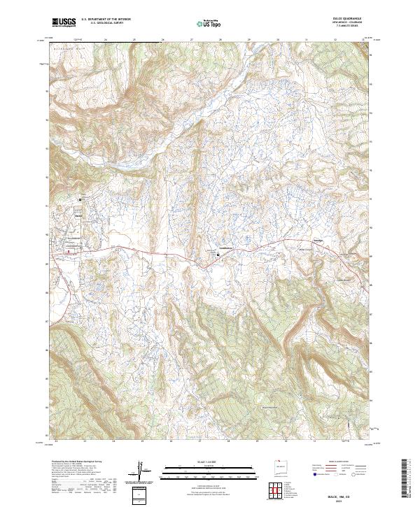
Dulce, the tribal headquarters of the Jicarilla Apache Nation, serves as the primary hub of this high-elevation landscape along the border of Rio Arriba County and Colorado. The community layout is centered around local staples like Jicarilla Blvd and Stadium Rd, with the Dulce Community Cem overlooking the settlement. To the east, Lumberton and the small siding of Amargo sit along the winding course of Amargo Creek, connected by US Route 64. The area’s spiritual geography is marked by Saint Francis Catholic church near Lumberton.
Find a feature on this map
58 named features on this map. Tap any name to fly to it.
Don’t see what you’re looking for? This feature index may not catch every label — zoom into the map to look around manually.
Map Details
Editions of this 2023 Dulce Map
This is the sole edition of this map. No revisions or reprints were ever made.
Other maps of this area

1889 · Largo
USGS Topo · 1:250,000

1895 · Largo
USGS Topo · 1:250,000

1913 · Summitville
USGS Topo · 1:125,000

1915 · Summitville
USGS Topo · 1:125,000

1924 · Pagosa Springs
USGS Topo · 1:125,000

1927 · Pagosa Springs
USGS Topo · 1:125,000

1945 · Durango
USGS Topo · 1:250,000

1953 · Durango
USGS Topo · 1:250,000

1954 · Durango
USGS Topo · 1:250,000

1954 · Aztec
USGS Topo · 1:250,000