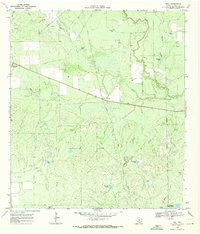
1969 Map of Dull
USGS Topo · Published 1971About this map
Cibolo Creek and the Frio River converge in this corner of La Salle County, defining a landscape marked by ranching infrastructure and early industrial marks. The settlement of Los Angeles sits at the western edge, linked to the smaller outpost of Dull by a straight thoroughfare that runs parallel to an Old Railroad Grade. This decommissioned rail line provides a clear look at the transportation history of South Texas before the modernization of the local road network.
Find a feature on this map
24 named features on this map. Tap any name to fly to it.
Don’t see what you’re looking for? This feature index may not catch every label — zoom into the map to look around manually.
Map Details
Editions of this 1969 Dull Map
This is the sole edition of this map. No revisions or reprints were ever made.
Other maps of this area

1929 · Cotulla
USGS Topo · 1:125,000

1940 · Cotulla
USGS Topo · 1:62,500

1942 · Fowlerton
USGS Topo · 1:62,500

1942 · Dilley
USGS Topo · 1:62,500

1953 · Crystal City
USGS Topo · 1:250,000

1955 · Crystal City
USGS Topo · 1:250,000

1956 · Hindes
USGS Topo · 1:62,500

1956 · Fowlerton
USGS Topo · 1:62,500

1961 · Crystal City
USGS Topo · 1:250,000

1968 · Crystal City
USGS Topo · 1:250,000