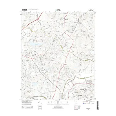
2014 Map of Duluth
USGS Topo · Published 2014About this map
The Chattahoochee River National Recreation Area serves as a natural spine for this 2014 survey, where the river's path defines the borders between Fulton, Forsyth, and Gwinnett counties. The landscape is a dense network of suburban development and modern corridors like Peachtree Pky and Medlock Bridge Rd, yet it preserves significant markers of its agrarian and family-history past. Genealogists can find numerous burial grounds including Bethlehem Cem, Sharon Cem, and Warsaw Cem. The river crossing remains a focal point of the local geography, featuring several named spans such as Abbotts Bridge, McClure Bridge, and Rogers Bridge. Near the city of Duluth, historical industry is recalled by Rogers Mill, while the suburban expansion of Alpharetta and the community of Ocee characterize the western portion of the quadrangle.
Find a feature on this map
49 named features on this map. Tap any name to fly to it.
Don’t see what you’re looking for? This feature index may not catch every label — zoom into the map to look around manually.
Map Details
Editions of this 2014 Duluth Map
This is the sole edition of this map. No revisions or reprints were ever made.
Other maps of this area

1888 · Atlanta
USGS Topo · 1:125,000

1890 · Suwanee
USGS Topo · 1:125,000

1890 · Atlanta
USGS Topo · 1:125,000

1892 · Atlanta
USGS Topo · 1:125,000

1894 · Suwanee
USGS Topo · 1:125,000

1895 · Atlanta
USGS Topo · 1:125,000

1953 · Atlanta
USGS Topo · 1:250,000

1954 · Chamblee
USGS Topo · 1:24,000

1955 · Rome
USGS Topo · 1:250,000

1956 · Duluth
USGS Topo · 1:24,000