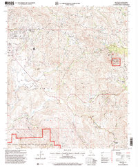
1997 Map of Dulzura
USGS Topo · Published 2000About this map
Jamul and Dulzura anchor this late-century landscape where suburban expansion meets the protected terrain of the Jamul Mountains. The map reveals a community defined by its topography, with settlements like North Jamul and Engineer Springs clustered along vital corridors like Lyons Valley Road. While modern Communication Facilities top high points like Lyons Peak, the map preserves older local landmarks including the St Francis Xavier Cem and Jamul Las Flores Sch.
Find a feature on this map
45 named features on this map. Tap any name to fly to it.
Don’t see what you’re looking for? This feature index may not catch every label — zoom into the map to look around manually.
Map Details
Editions of this 1997 Dulzura Map
This is the sole edition of this map. No revisions or reprints were ever made.
Other maps of this area

1893 · El Cajon
USGS Topo · 1:62,500

1901 · Elcajon
USGS Topo · 1:62,500

1903 · Cuyamaca
USGS Topo · 1:125,000

1903 · Elcajon
USGS Topo · 1:62,500

1904 · Southern California Sheet No. 2
USGS Topo · 1:250,000

1939 · El Cajon
USGS Topo · 1:62,500

1942 · Potrero
USGS Topo · 1:48,000

1942 · El Cajon
USGS Topo · 1:62,500

1942 · Cuyamaca Peak
USGS Topo · 1:62,500

1943 · Jamul
USGS Topo · 1:62,500