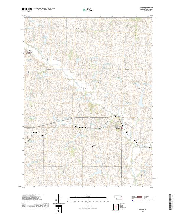
1966 Map of Dunbar
USGS Topo · Published 1966About this map
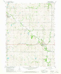
North Fork Little Nemaha River and its numerous tributaries, including Deer Creek and Wilson Creek, define the landscape of eastern Otoe County in the mid-1960s. The village of Dunbar sits at the convergence of several waterways and the Chicago Burlington and Quincy railroad, which follows the river valley. A notable piece of local history is recorded in the Old Railroad Grade north of the river, tracing a former transportation corridor that once connected these agricultural communities.
Find a feature on this map
23 named features on this map. Tap any name to fly to it.
Don’t see what you’re looking for? This feature index may not catch every label — zoom into the map to look around manually.
Map Details
Editions of this 1966 Dunbar Map
This is the sole edition of this map. No revisions or reprints were ever made.
Historical Maps of Dunbar Through Time
5 maps found