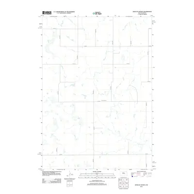
2012 Map of Duncan Church
USGS Topo · Published 2012About this map
Duncan Church stands as the central landmark in this portion of Buffalo County, marking a localized spiritual and community anchor in a landscape defined by expansive prairies and intermittent drainages. The topography is shaped by the wandering course of Crow Cr, which meanders through the central and eastern portions of the quadrangle. The map reflects a structured rural grid system typical of South Dakota's interior, where section-line roads like 217th St, 219th St, and 221st St provide the primary means of navigation between isolated farmsteads and agricultural plots. The density of these roads, including north-south corridors like 354th Ave and 356th Ave, illustrates a persistent pattern of land division that has governed this region since its initial settlement.
Find a feature on this map
14 named features on this map. Tap any name to fly to it.
Don’t see what you’re looking for? This feature index may not catch every label — zoom into the map to look around manually.
Map Details
Editions of this 2012 Duncan Church Map
This is the sole edition of this map. No revisions or reprints were ever made.
Other maps of this area

1949 · Vayland SW
USGS Topo · 1:24,000

1951 · Vayland SW
USGS Topo · 1:24,000

1953 · Huron
USGS Topo · 1:250,000

1954 · Huron
USGS Topo · 1:250,000

1973 · Big Bend Dam 4 SE
USGS Topo · 1:24,000

1973 · Ames
USGS Topo · 1:24,000

1973 · Gannvalley
USGS Topo · 1:24,000

1973 · Miller Dale Colony SW
USGS Topo · 1:24,000

1973 · Big Bend Dam 4 NW
USGS Topo · 1:24,000

1973 · Big Bend Dam 4 NE
USGS Topo · 1:24,000