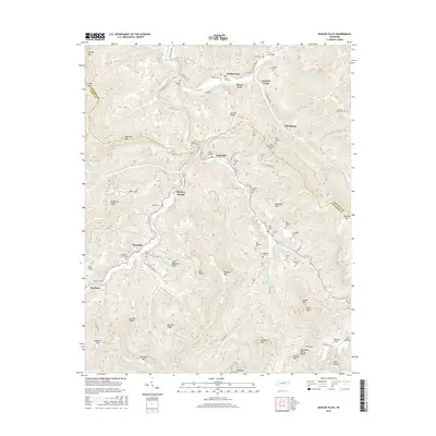
2016 Map of Duncan Flats
USGS Topo · Published 2016About this map
The New River carves a winding path through this portion of the Cumberland Mountains, where the borders of Anderson, Campbell, and Scott counties meet. Small communities and resource camps like Stainville, Clinchmore, and Welch Camp are positioned along the narrow valley floors and creek beds, connected by a network of rural routes such as New River Rd. The topography is dominated by steep ridges including Daugherty Ridge and Big Fork Ridge, which rise toward the Tennessee Valley Divide at the southern edge of the sheet.
Find a feature on this map
98 named features on this map. Tap any name to fly to it.
Don’t see what you’re looking for? This feature index may not catch every label — zoom into the map to look around manually.
Map Details
Editions of this 2016 Duncan Flats Map
This is the sole edition of this map. No revisions or reprints were ever made.
Other maps of this area

1893 · Briceville
USGS Topo · 1:125,000

1895 · Briceville
USGS Topo · 1:125,000

1896 · Briceville
USGS Topo · 1:125,000

1936 · Hogbell Gap
USGS Topo · 1:24,000

1936 · Block
USGS Topo · 1:24,000

1936 · Jacksboro
USGS Topo · 1:24,000

1936 · Duncan Flats
USGS Topo · 1:24,000

1936 · Windrock
USGS Topo · 1:24,000

1936 · La Follette
USGS Topo · 1:48,000

1936 · Norris Dam
USGS Topo · 1:48,000