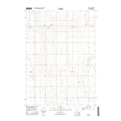
2015 Map of Duncan
USGS Topo · Published 2015About this map
Duncan serves as the primary settlement on this North Central Iowa prairie landscape, situated along the crossroads of Highway 18. This 2015 survey illustrates a highly managed agricultural environment, where the headwaters of the Iowa River are clearly defined. The terrain is bifurcated by the West Branch Iowa River and the East Branch Iowa River, which flank a network of artificial waterways like Drainage Ditch Number 6. This complex drainage system highlights the intensive land-use patterns required to maintain the region's productive farmland. For those researching local heritage, several burial grounds are scattered throughout the township, including Saint John Cem near the town center and Saint Boniface Cem to the east. To the northwest, Eagle Lake remains a prominent natural water body amidst the grid of country roads, offering a contrast to the engineered channels that dominate the southern sections of the quadrangle.
Find a feature on this map
41 named features on this map. Tap any name to fly to it.
Don’t see what you’re looking for? This feature index may not catch every label — zoom into the map to look around manually.
Map Details
Editions of this 2015 Duncan Map
This is the sole edition of this map. No revisions or reprints were ever made.
Other maps of this area

1954 · Mason City
USGS Topo · 1:250,000

1954 · Waterloo
USGS Topo · 1:250,000

1955 · Waterloo
USGS Topo · 1:250,000

1957 · Mason City
USGS Topo · 1:250,000

1958 · Mason City
USGS Topo · 1:250,000

1972 · Kanawha
USGS Topo · 1:24,000

1972 · Hayfield
USGS Topo · 1:24,000

1972 · Olaf
USGS Topo · 1:24,000

1972 · Crystal Lake
USGS Topo · 1:24,000
1972 · Duncan
USGS Topo · 1:24,000