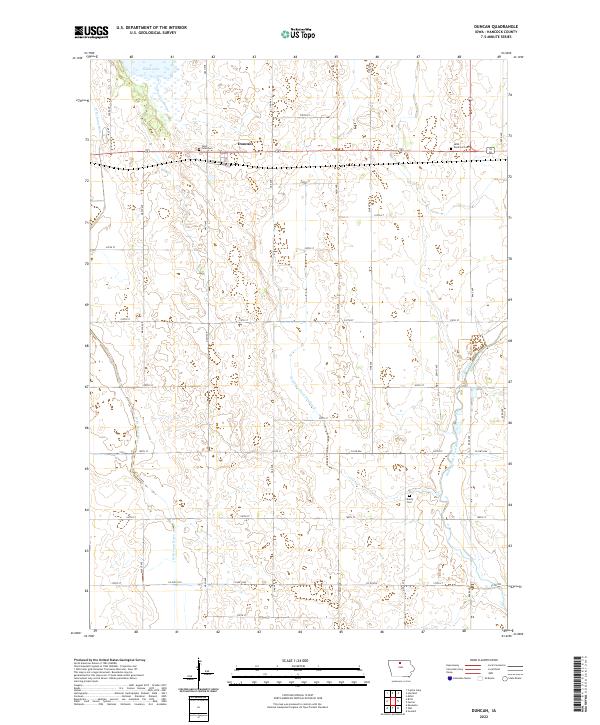
2022 Map of Duncan
USGS Topo · Published 2022About this map
The unincorporated community of Duncan sits at the heart of this Hancock County landscape, defined by the headwaters of the Iowa River. The terrain is a clear illustration of agricultural water management in the Midwest, where the natural winding course of the W Br Iowa River and the East Branch Iowa River are supplemented by the engineered precision of Drainage Ditch Number 6. This network of waterways drains the low-lying areas surrounding Eagle Lake to support the surrounding farmland.
Find a feature on this map
42 named features on this map. Tap any name to fly to it.
Don’t see what you’re looking for? This feature index may not catch every label — zoom into the map to look around manually.
Map Details
Editions of this 2022 Duncan Map
This is the sole edition of this map. No revisions or reprints were ever made.
Other maps of this area

1954 · Mason City
USGS Topo · 1:250,000

1954 · Waterloo
USGS Topo · 1:250,000

1955 · Waterloo
USGS Topo · 1:250,000

1957 · Mason City
USGS Topo · 1:250,000

1958 · Mason City
USGS Topo · 1:250,000

1972 · Kanawha
USGS Topo · 1:24,000

1972 · Hayfield
USGS Topo · 1:24,000

1972 · Olaf
USGS Topo · 1:24,000

1972 · Crystal Lake
USGS Topo · 1:24,000
1972 · Duncan
USGS Topo · 1:24,000