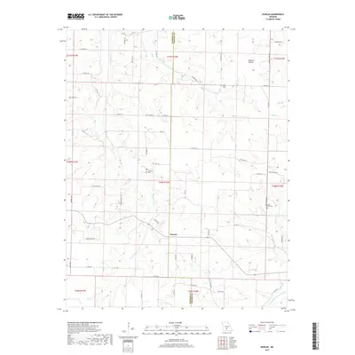
2017 Map of Duncan
USGS Topo · Published 2017About this map
Duncan serves as a central point of settlement in this Ozark landscape, situated where the Webster and Wright county line divides the terrain. The map reveals a rural geography defined by its watercourses, including the Woods Fork Gasconade River in the southeast and various tributaries like Cantrell Cr, Hyde Cr, and Bowman Cr that carve through the hills. This 2017 survey documents a network of county roads and historic paths such as Historic Rd and Old Church Rd, reflecting long-established transit patterns between local farmsteads.
Find a feature on this map
59 named features on this map. Tap any name to fly to it.
Don’t see what you’re looking for? This feature index may not catch every label — zoom into the map to look around manually.
Map Details
Editions of this 2017 Duncan Map
This is the sole edition of this map. No revisions or reprints were ever made.
Other maps of this area

1939 · Fordland
USGS Topo · 1:62,500

1942 · Fordland
USGS Topo · 1:62,500

1946 · Niangua
USGS Topo · 1:62,500

1948 · Niangua
USGS Topo · 1:62,500

1951 · Mansfield NE
USGS Topo · 1:24,000

1951 · Mansfield NW
USGS Topo · 1:24,000

1954 · Springfield
USGS Topo · 1:250,000

1956 · Duncan
USGS Topo · 1:24,000

1956 · Rader
USGS Topo · 1:24,000
1956 · Hartville
USGS Topo · 1:24,000