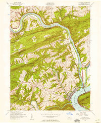
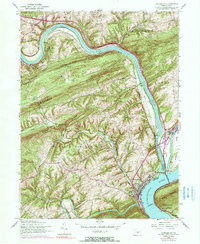
1952 Map of Duncannon
USGS Topo · Published 1958About this map
Duncannon sits at the vital confluence where the Juniata River meets the Susquehanna River, a landscape defined by industrial corridors and river navigation. In the early 1950s, the remnants of the Juniata River (Abandoned Canal) traced the water's edge alongside the active Pennsylvania Railroad, illustrating the shift from canal era transport to the rail and highway age. The topography is dominated by a series of parallel ridges, including Hickory Ridge and Mahanoy Ridge, which channeled development into the narrow valleys.
Find a feature on this map
57 named features on this map. Tap any name to fly to it.
Don’t see what you’re looking for? This feature index may not catch every label — zoom into the map to look around manually.
Map Details
Editions of this 1952 Duncannon Map
5 editions found
Other maps of this area

1892 · Harrisburg
USGS Topo · 1:62,500

1893 · Millersburg
USGS Topo · 1:62,500

1899 · Harrisburg
USGS Topo · 1:62,500

1907 · New Bloomfield
USGS Topo · 1:62,500

1907 · Millerstown
USGS Topo · 1:62,500

1924 · Harrisburg
USGS Topo · 1:62,500

1943 · Millerstown
USGS Topo · 1:62,500

1943 · Millersburg
USGS Topo · 1:62,500

1943 · Harrisburg
USGS Topo · 1:62,500

1943 · New Bloomfield
USGS Topo · 1:62,500