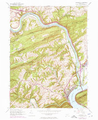
1952 Map of Duncannon
USGS Topo · Published 1975About this map
The Juniata River and Susquehanna River converge at the heart of this mid-century landscape, framing the riverfront borough of Duncannon. This area is a critical transport corridor where the Penn Central tracks and the William Penn Highway follow the water's edge, tracing the same path as the earlier Abandoned Canal. The complex river geography is highlighted by Haldeman Island and the strategic crossing at Clarks Ferry Bridge.
Find a feature on this map
54 named features on this map. Tap any name to fly to it.
Don’t see what you’re looking for? This feature index may not catch every label — zoom into the map to look around manually.
Map Details
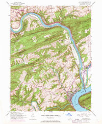
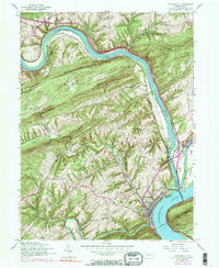
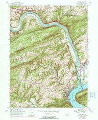
Editions of this 1952 Duncannon Map
5 editions found

Other maps of this area

1892 · Harrisburg
USGS Topo · 1:62,500

1893 · Millersburg
USGS Topo · 1:62,500

1899 · Harrisburg
USGS Topo · 1:62,500

1907 · New Bloomfield
USGS Topo · 1:62,500

1907 · Millerstown
USGS Topo · 1:62,500

1924 · Harrisburg
USGS Topo · 1:62,500

1943 · Millerstown
USGS Topo · 1:62,500

1943 · Millersburg
USGS Topo · 1:62,500

1943 · Harrisburg
USGS Topo · 1:62,500

1943 · New Bloomfield
USGS Topo · 1:62,500