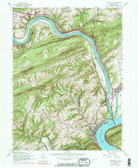
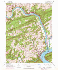
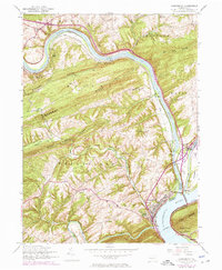
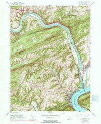
1952 Map of Duncannon
USGS Topo · Published 1990About this map
The Juniata River and Susquehanna River converge at the heart of this landscape, defining the industrial and transport history of Duncannon. By the mid-20th century, the Juniata Canal remained as a trace of earlier commerce, bypassed by the heavy tracks of the Penn Central railroad and the William Penn Highway. The town itself is a dense node of activity, featuring the Highland Cemetery, an Athletic field, and the Penn-Two Consolidated School.
Find a feature on this map
44 named features on this map. Tap any name to fly to it.
Don’t see what you’re looking for? This feature index may not catch every label — zoom into the map to look around manually.
Map Details
Editions of this 1952 Duncannon Map
5 editions found

Other maps of this area

1892 · Harrisburg
USGS Topo · 1:62,500

1893 · Millersburg
USGS Topo · 1:62,500

1899 · Harrisburg
USGS Topo · 1:62,500

1907 · New Bloomfield
USGS Topo · 1:62,500

1907 · Millerstown
USGS Topo · 1:62,500

1924 · Harrisburg
USGS Topo · 1:62,500

1943 · Millerstown
USGS Topo · 1:62,500

1943 · Millersburg
USGS Topo · 1:62,500

1943 · Harrisburg
USGS Topo · 1:62,500

1943 · New Bloomfield
USGS Topo · 1:62,500