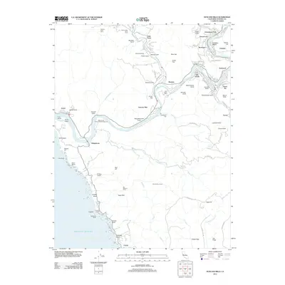
2012 Map of Duncans Mills
USGS Topo · Published 2012About this map
Duncans Mills serves as a central hub on this survey, where the winding Russian River meets the confluence of Austin Cr. The landscape transitions from the coastal bluffs of the Pacific to the deeply incised gulches and ridges of the interior, including Hogback and Red Hill. The settlement pattern reflects a mix of riverside communities like Villa Grande, Guernewood, and Monte Rio, alongside established agricultural and recreational sites such as Bull Barn Ranch and the Willow Creek Environmental Campground.
Find a feature on this map
100 named features on this map. Tap any name to fly to it.
Don’t see what you’re looking for? This feature index may not catch every label — zoom into the map to look around manually.
Map Details
Editions of this 2012 Duncans Mills Map
This is the sole edition of this map. No revisions or reprints were ever made.
Other maps of this area

1920 · Healdsburg
USGS Topo · 1:62,500

1921 · Skaggs
USGS Topo · 1:62,500

1933 · Healdsburg
USGS Topo · 1:48,000

1935 · Sebastopol
USGS Topo · 1:48,000

1940 · Healdsburg
USGS Topo · 1:62,500

1942 · Sebastopol
USGS Topo · 1:62,500

1942 · Bodega Head
USGS Topo · 1:24,000

1942 · Arched Rock
USGS Topo · 1:24,000

1943 · Cazadero
USGS Topo · 1:24,000

1943 · Duncans Mills
USGS Topo · 1:24,000